Terrain Classification

At CMU, the Unmanned Ground Vehicle (UGV) project has demonstrated autonomous planning, mapping, and off-road navigation skills using the NavLab II, a modified Army HMMWV. But despite its impressive capabilities, NavLab II is unable to distinguish between rocks and tall grass, trees and hillsides, or even mud and hard ground. As a consequence, the vehicle plans and navigates conservatively, avoiding all objects that may be potential hazards. By identifying and classifying the different types of terrain in a scene, we reduce the number of false positive obstacles, such as tall grass, as well as false negatives, such as water and mud.
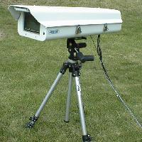
Terrain classification is difficult with a monochrome camera because different terrain types may produce the same image intensity. A color camera alleviates this problem somewhat, but the off-road terrain in which we are interested often contains only muted colors, which are difficult to distingish using only the red, green, and blue components of the scene. The AOTF camera provides us with fine-grain measurements over the full visible spectrum as well as the near infrared.

